Posted in Case Studies on June 16th, 2015
Background
A Colortrac SmartLF Gx* wide format scanner has been used to scan historic First World War trench maps for display on hand-held GPS / PDA devices as part of a battlefield satellite navigation (Sat Nav) system. With Great War Digital’s Linesman software users can view the scanned maps as a 3D digital terrain model (DTM) and, while walking through the topography of the old battlefield, see exactly where they are at any time. The Western Front trench syst em of the First World War is disappearing. In the 90 years since the last shot was fired, the vast trench system that ran from Switzerland to Belgium’s North Sea coast has been filled in by man or reclaimed by nature. Like the 160,000 British missing, presumed dead, the trench system has slowly disappeared from view, merging into one with the rolling green farmlands and woods of France and Belgium. Each year thousands of descendants of those who fought in the British Empire forces – Britons, Australians, Canadians, Indians, New Zealanders, South Africans and others – visit the battlefields of the Great War. Many simply want to visit the grave of an ancestor, others come to visit the actual site where a relative was mentioned in Despatches or won a medal for their action. Visitors find the many well-signposted cemeteries and memorials easily enough but the trench systems are much more elusive. Most of the trenches are now mere folds in the ground, a shallow ditch at best in most places. The best way to locate the trench systems are the battlefield maps printed by the British Army Royal Engineers between 1914 – 1918. Today, good examples of these maps are scarce. Most are preserved in national institutions like Britain’s National Archives, the Imperial War Museum and the Royal Geographical Society, as well as in smaller numbers in private collections throughout the world.
The project
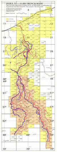
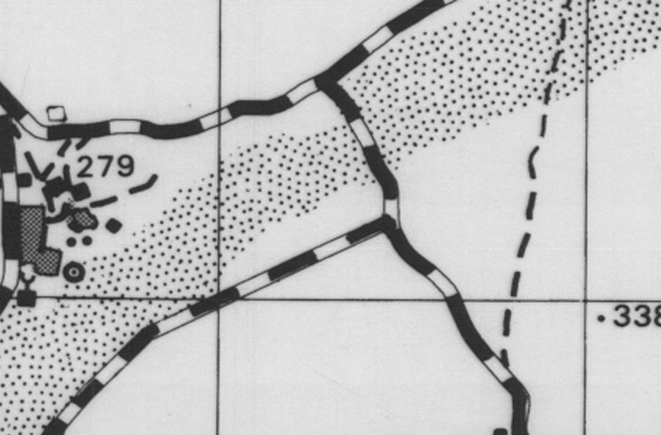
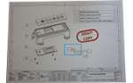
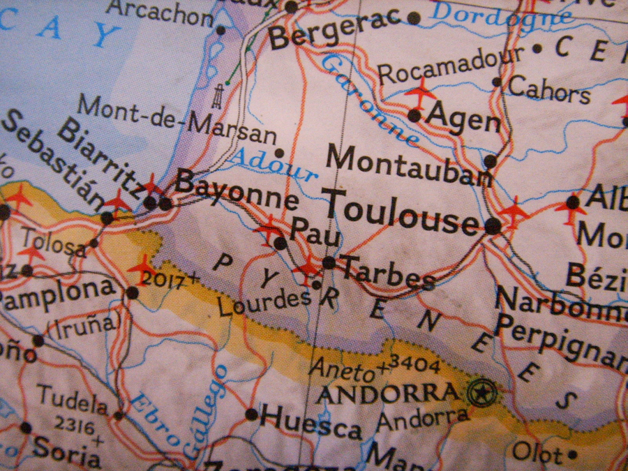
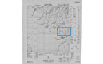
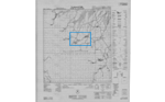
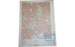
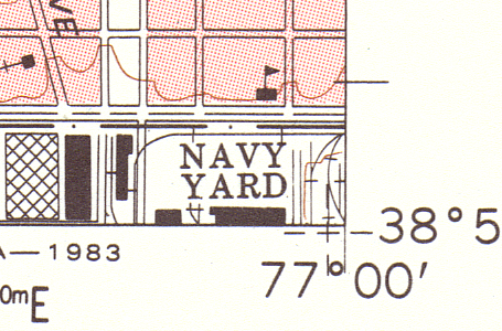
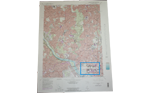
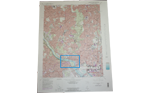
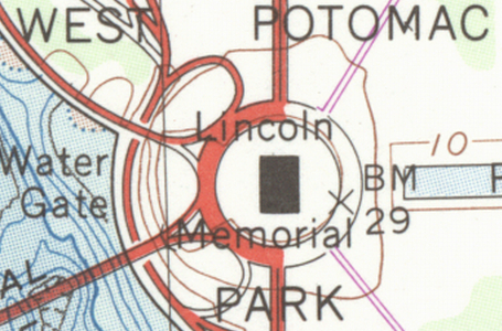
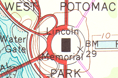
Index of trench maps at 1:10 000 scale. Each rectangle is an A0 trench map.
Four years ago Great War Digital, a British company, began a project to collect and conserve the trench maps of the First World War by digital scanning and by making them available on DVD to the public. Great War Digital’s aim was to make these historic trench maps available as scanned, geo-referenced maps that could be displayed on popular hand-held GPS / PDA devices. This would allow the user to follow the actual trench system by car or on foot and see their exact location relative to the trench maps at any time.
The result is a Great War Digital software program called LinesMan, “The Great War Western Front GPS Companion”. Great War Digital believe that Linesman is the first commercial application of historical data to a satellite navigation system. The first release of Linesman included 750 scans of trench maps covering the British sector of the Western Front which were scanned by Great War Digital’s local scanning bureau. However, almost as soon as this was done another source of some 800 trench maps became available in France. As all the scanning of these French trench maps had to be done in France, Great War Digital decided to invest in a wide format scanner and do the job themselves on-site. Trench maps are usually A0-size maps which fold down to pocket-book size. Drawn on linen in 1:10,000 scale, they have a hard outer cover made of thick cardboard. When opened the cover is attached to the outside edge, making scanning awkward or impossible on thin media scanners. Owning a scanner would give Great War Digital the flexibility to scan when and where they wanted with the added benefit of being less expensive than using a scanning bureau.
Which scanner?
Great War Digital had two main requirements for any scanner they bought.
First, because users of Linesman need to zoom into the scanned image at high magnification in order to see as much detail as possible, they required sharp, high quality scans. They required the scan quality to be at least as sharp as what they had got from their scanning bureau. As the scanning bureau had used a CCD (charge couple device) scanner to achieve good results, Great War Digital decided early on in their scanner selection process that what they really required was a color CCD scanner similar to the one used by the scanning bureau.
Second, the scanned images should save as suitably compressed files. Great War Digital contacted Softcover, a Colortrac reseller, who recommended the SmartLF Gx enhanced color scanner because it had a thick media capability for scanning the thicker French trench maps and because it was the fastest color CCD scanner in the Gx series. The SmartLF Gx offers motorised thick media scanning of mounted originals up to 0.8″ (2cm) thickness and up to 48″ in width (42″ image size) and provides fast, high quality scans of large format photographs, satellite images, artwork and documents that require a wide color gamut and high dynamic range.
Most importantly, the SmartLF Gx accurately captures the finest color details of maps. Softcover arranged for Great War Digital’s two directors, Guy Smith and Jerry Whitehead, to receive a demonstration of a Colortrac SmartLF Gx at Colortrac’s head office in St Ives, Cambridgeshire.
Peter Brown, Director at Colortrac, recalls Great War Digital’s visit to St Ives as a “memorable day. It’s not too often that we get to speak directly with potential end user customers or ones with such an interesting application. It was a strange, almost reverent feeling to hold an original 90 year-old trench map in my hands and through that connect with the originators and users of the document and imagine what they had experienced and endured during the First World War. I find it difficult to explain fully how I felt. This was a document that was much, much more than a piece of vellum with some information printed on it” he said.
Guy Smith, Great War Digital’s technical director, showed Colortrac how Great War Digital’s Linesman software integrated the trench map data produced by the scanning process into a modern digital terrain map (DTM), allowing the user to zoom in and out of the map, change the ‘camera’ angle and position, etc., so that the Linesman user could walk along the length and breadth of the trench system with all the 3D topography of the land reproduced.
“It is amazing what you can do with a laptop and software these days!” said Peter de Winter-Brown. Great War Digital purchased a Colortrac SmartLF Gx from Softcover a few months later. After taking the scanner on a short visit to Deepcut Barracks in the UK, Jerry Whitehead removed the Colortrac SmartLF Gx from its bulky shipping packaging and transported the scanner in its inner box with its stand in the rear of his Land Rover Discovery 3 to France. During a break in his busy schedule, Whitehead explained how the scanning project went in France. “Two of us went on each trip. We have now been to France twice and to a remote site in England and have scanned approximately 800 maps faultlessly.
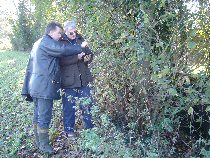
Jerry Whitehead (right) using LinesMan to locate trenches and bunkers at Cambrai.
“On arrival at each destination we set up the scanner on its stand and allowed it a one hour warm-up and then performed normalisation and auto-stitch routines. There were no serious problems. Each evening we left the scanner powered On such that the following morning we could repeat the normalization routine and then recommence scanning straight away.” Most importantly, the SmartLF Gx gave Great War Digital the image quality and production speed they wanted. “The minimum scan quality required was 300 dpi, 24-bit (16 million colors)” said Whitehead. “This was achieved on all map scans, up to A0 size, with ease. The files were initially prepared uncompressed for archival standards and subsequently reduced in resolution and size to run with proprietary software and this to date has not presented any problems. The Colortrac Gx provides at least the quality previously supplied by the bureau with the advantage of us being directly in control. The speed is fine, quite remarkable actually. Even with a large map scanned in high resolution it zips through quite quickly. We scanned 800 or so trench maps during two trips to France. Working about six hours a day we scanned 500 maps in four-and-a-half days on one trip and about 300 maps in three-and-a-half days on another”.
Colortrac Benefits
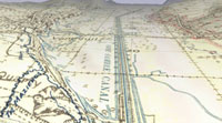
Great War Digital have created digitally enhanced Relief Shaded versions of the Trench Maps.
“The scanner has fulfilled our needs so far and provides us with more flexibility than the bureau, thus in our situation the scanner has proved to be good value for money. We would be prepared to recommend this scanner to others. We do not regret purchasing it. The results of our initial scanning are excellent.” Linesman is currently available as a two box DVD set of 750 British trench maps in 1:10,000 scale. The new version with the SmartLF scans will become available in 2008. Linesman makes trench maps accessible to amateur enthusiasts and professional historians and archaeologists alike, both as an archival tool and as a navigational companion for battlefield research. Jerry Whitehead uses Linesman extensively on his Great War battlefield tours of the Western Front, as do other battlefield tour operators. It has proven useful for taking customers of his Kingshead Adventures battlefield tours to precise locations on the battlefield where their relatives saw action.
“There’s a lot still to do” said Jerry Whitehead. “There are many individual trench maps in private hands. There are also tunnelers’ maps and maps of Gallipoli. German and American maps are something for the future.” He estimates that he has another 2 – 3 years scanning work ahead of him. The Colortrac SmartLF Gx will be at the forefront of this project to capture the British Empire’s and now Europe’s Great War heritage.
“Colortrac is very proud to be associated with this project” said Peter Brown. “It not only helps to preserve these historic maps but also brings them to life and makes them accessible for this and future generations who try to understand and remember the sacrifices of our forefathers.”
* For all current models see our Large Format Scanner Overview.
Links www.greatwardigital.com